IFR Routes

- Home
- /
- Our Services
- /
- Infrastructure & Technology
- /
- IFR Routes
Navigating Maine
During its first two decades of service, LifeFlight worked with state government officials, the FAA, the USDA, and Maine Emergency Management to develop a comprehensive statewide aviation infrastructure. This includes hospital and community helipads, weather reporting capabilities, instrument approaches, and rural airport improvements. LifeFlight’s collaborative approach resulted in more than $25 million in federal funds and $5 million in state bond funding.
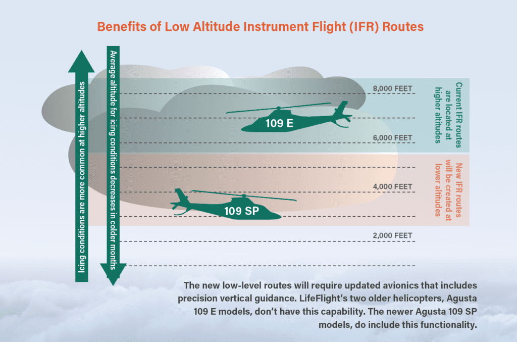
Operating helicopters and airplanes in Maine’s rugged geography has always been a challenge for LifeFlight, one that we’ve been tackling since day one. Challenges remain, however, and there are still patients who we can’t reach by air because of weather conditions like fog and icing. With support from the Federal Aviation Administration (FAA), we’re working to make that number much smaller. The effort is rooted in navigation and consists of three major components: the nationwide mandatory shift from ground-based to satellite-based navigation (GPS); the creation of lower altitude, more precise flight routes across Maine; and helicopters capable of operating in the new system.
Today’s airspace is primarily made up of defined routes that go from one ground-based navigation station to another, and whose coordinates are accessible by aircraft pilots and air traffic controllers (ATC). Think of these routes as tunnels through the sky, defined by radio signals or GPS coordinates along the way. Because monitoring of the routes by ATC is based on data provided by ground-based radar, these tunnels are quite wide and often at a high altitude where bad weather and freezing conditions are more common. Now, when a call for help comes in to LifeFlight, our helicopter pilots check the weather along the route to determine if the mission can be accomplished safely. For most missions, the helicopters must use these predefined instrument flight (IFR) routes to get from point A to point B, which means even though the weather at 3,000 feet is acceptable, we can’t accept the mission because we have to fly a route that takes us to 7,000 feet where the temperature and humidity are producing icing conditions.
The FAA’s NextGen Project
A few years ago, the FAA launched a multiyear modernization project aimed at moving all airspace infrastructure to a system that uses data provided by satellite-based GPS, which is much more detailed and accurate than ground-based radar. As the FAA implements this technology, new routes that are more precise can be created. Specifically, the new routes allow precision operations at lower altitudes where icing is less common, improving the safety and reliability of LifeFlight in more weather conditions. This new statewide network of low-altitude instrument flight routes will be the first of its kind in the nation. The FAA, which is developing the routes, expects the finished network will serve as a national demonstration project for other states. The recently passed Federal Budget and FAA Reauthorization provide $5 million to support the project. The provision was sponsored by Senator Susan Collins with support from the Maine delegation. Once the routes are complete, LifeFlight will be able to answer more requests by air because the helicopter can fly the mission at a lower altitude where the weather conditions meet our stringent safety minimums.