For EMS/Communities
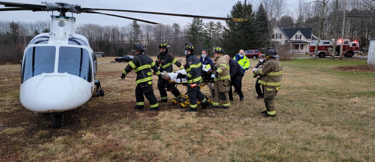
When an accident or other critical injury or illness threatens life or limb, there is no substitute for quickly mobilized, highly skilled emergency medical providers working together to ensure patients receive the care they need. LifeFlight’s specially trained paramedics and critical care nurses bring intensive care skills and equipment directly to the patient, and 20% of the time, that means directly to the scene of an accident.
Safety is paramount when landing at unprotected landing zones on the sides of highways, fields, or clearings in the woods. LifeFlight has developed resources and training programs to assist EMS and public safety agencies in establishing scene landing zones.
LifeFlight is a unique medical provider that supports every community in Maine. As a nonprofit organization, we rely on support from Maine communities to ensure that all Mainers have access to critical care and medical transport when they need it, 24/7/365. Click here to learn more about our community giving program.
Creating and Registering a Landing Zone
While LifeFlight responds to scene emergencies and often lands in an ad hoc LZ coordinated by local EMS/ Fire Rescue it is incredibly helpful to have preplanned LZ’s in every community which we can access day and night and all seasons. Preplanning your LZ’s allows for a more rigorous safety check for obstructions and wires.
LifeFlight has worked with communities, EMS, and public safety agencies across the state to develop a comprehensive database of safe landing zones across the state.
You can access information on how to create an LZ here. Once you have developed the LZ, you can forward the information to be included in our LZ database.
- When providing GPS coordinates for the site, please use Datum WGS84, and degree minutes/decimal minutes format.
- If you wish to provide photographs or satellite imagery of the location, attach them here or email them to kymadigan@lifeflightmaine.org. If you do include photographs, please take them from the center out, one photo each to the north, south, east, and west. Also please include any potential hazards such as wires, trees, posts, rocks, etc.
All the LZ’s are entered into the database and shared with the 911 GIS office, allowing all 911PSAP’s and emergency response personnel access to LifeFlight’s landing zone information.
Remote Access Project
In an effort to improve response time for scene calls involving remote snowmobile, ATV, and recreational accidents, LifeFlight has been working with state and local agencies and clubs to establish landing zones along Maine’s extensive recreational trail system. So far, the project has identified more than 100 landing zones in isolated and rural areas. Large standardized signs displaying the site’s unique GPS coordinates have been erected at more than 40 of the LZ’s.
Ground Safety & User Courses
Assuring the safety of operations is LifeFlight’s first priority. This is even more critical for emergency scene call landing zones that need to be developed on the fly by public safety personnel. LifeFlight offers a no-cost Ground Safety and Users Course (GSUC) with Maine EMS-approved CME hours. The program is a combination of didactic and hands-on with the LifeFlight teams and aircraft.
