LifeFlight of Maine Completes Installation of 35 Weather Cameras Statewide
Cameras Available for Public Use
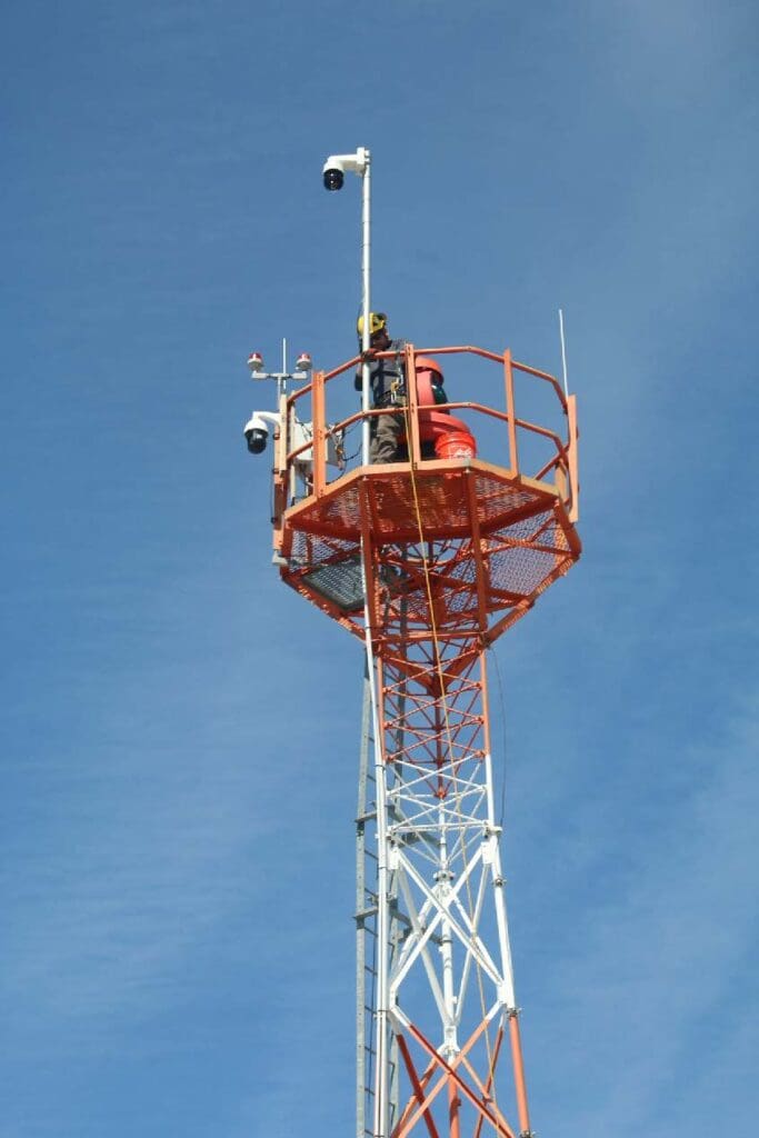
LifeFlight of Maine now has the largest collection of publicly accessible and privately maintained aviation weather cameras in the nation. The organization recently completed its weather cameras project with the installation of its 35th camera. Now, LifeFlight is working to share these cameras with the public.
LifeFlight’s pilots use the cameras for a real-time view of weather conditions, which further enhances aviation safety for pilots and expands access to critical healthcare for patients across the state. The cameras are also used to increase security at rural airports. The project was made possible by a grant awarded through the Maine Emergency Management Agency (MEMA). The cameras, which are also used by the Federal Aviation Administration (FAA), are installed in locations across the state. Images from the cameras are accessible to all pilots and the public on the FAA’s website. Part of LifeFlight’s mission is to make the aviation environment safer for all who use it and this project benefits aviators throughout New England.
The cameras allow LifeFlight’s pilots to check weather and runway conditions before flying to a location, increasing LifeFlight’s reliability when accessing patients in rural Maine. “If we have to fly to a location and then determine that an airport is unsafe to land at, that can create a delay in patient care,” says John Rolfson, LifeFlight’s aviation infrastructure engineer. When a LifeFlight pilot receives a request for a patient transport, their first duty is to check weather conditions to confirm they can safely fly to the patient and then safely fly that patient to the receiving hospital. The weather cameras allow the pilot to survey the airfield before taking off. For example, if a pilot sees a runway hasn’t been plowed after a snowstorm, a new landing location can be chosen before the crew leaves the hangar.
“The cameras offer another level of visibility during the operation,” says John. “They serve as an extra set of eyes for the crew. We’ve had challenges where the runway is occupied by an unauthorized vehicle. Other times, wild animals will move on to the runway. Having the ability to use these cameras to survey the airfield before landing is a major safety enhancement.”
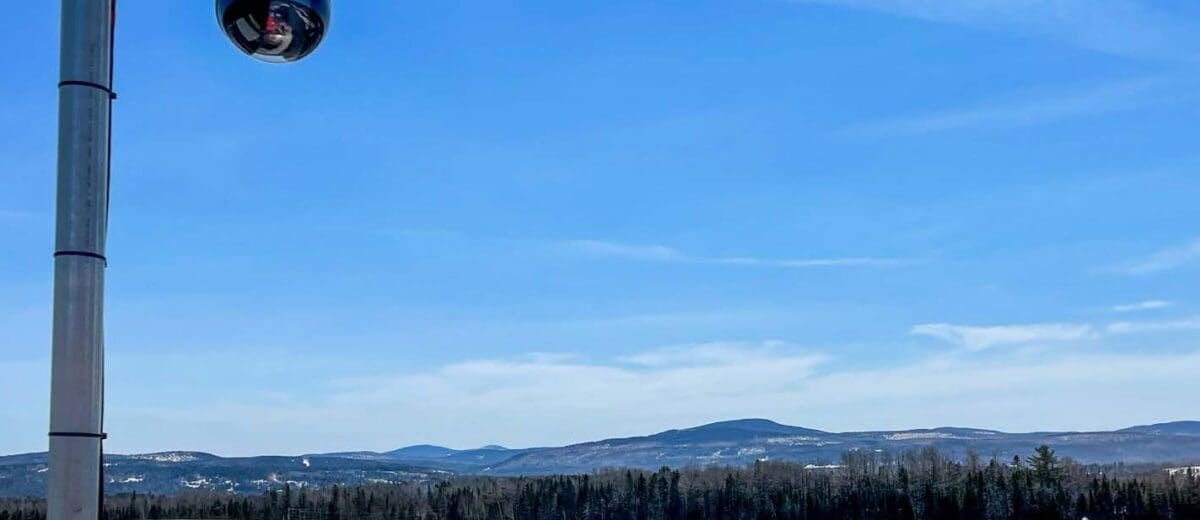
“Traditional weather reporting stations don’t always paint the full picture,” says John. For example, you may receive a clear weather report from the weather station, but a few miles away on the runway it may be snowing. The cameras can show pilots the weather conditions in real time.
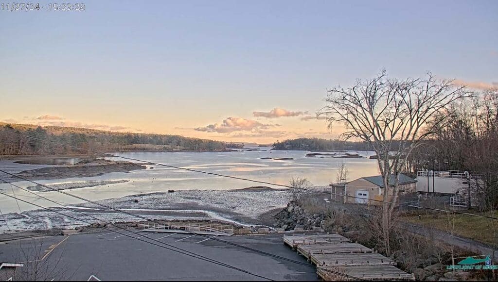
LifeFlight’s pilots and dispatchers have access to a live feed, where they can view current conditions. LifeFlight pilots can also view four directional still images, a six-hour timelapse, clear- day visual reference photos, and a variety of map layers for weather and navigation awareness. The cameras are automated, and snap photos every few minutes. These photos are then posted on the FAA’s website for the public to view.
The completion of this project benefits all aviators across Maine, not only those at LifeFlight. Dave Cullinan, the Operations Manager at Eastern Slope Regional Airport, says a camera was installed there about two years ago. He’s already seeing the benefits to aviators in the area.
“It helps pilots make better safety decisions, because it’s in real time. A lot of times pilots from the south of us, Massachusetts and further, when they want to come to Fryeburg, they can see what the actual conditions are like. And being close to the mountains, those conditions change quickly,” says Dave.
Dave says the small regional airport does not have someone in the office at all hours, so the security enhancement from the camera is a nice benefit as well.
The project is also serving as a model for air medical operations in other parts of the country with similarly complicated weather and geography to provide a cost-effective means to increase aviation safety.
